Seismic Surveying
As part of the site feasibility assessment, the Tri-State CCS Hub team will need to conduct seismic surveying to confirm the geology in the region is ideal for this type of project. We are planning for this work to begin in Fall 2025.
Seismic surveys create localized vibration in a limited area to collect seismic data that will determine if the geology is suitable for carbon dioxide sequestration deep underground. While residents in close proximity (100 feet or less) may feel slight vibrations from vibroseis trucks, these surveys are safe to the public, property and roadways.
What is a seismic survey?
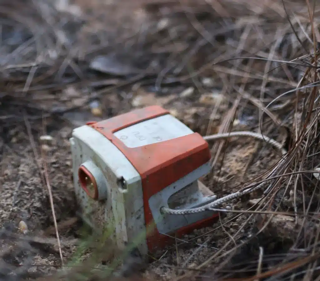
Seismic surveys use low-frequency sound waves that travel through solid rock and sediment layers beneath the earth’s surface to create maps of rock formations underground. This surveying is performed using sensors, called geophones, that are temporarily placed on the ground to listen to echoes from sound waves reflected from subsurface layers as shown below. Sound waves are also used in ultrasounds, though ultrasounds utilize high-frequency sound waves.
Seismic surveys determine geologic stability and map the safest locations for deep underground storage of carbon dioxide (CO2). The process is already used across a variety of industries, including water resources (such as locating groundwater), geothermal energy, oil and gas exploration and mining.
To minimize our footprint, we use a wide range of data and remote-sensing techniques before going into the field to conduct these surveys. Our field work is performed with “vibrioses” – or thumper – trucks; not with blasting or helicopters.
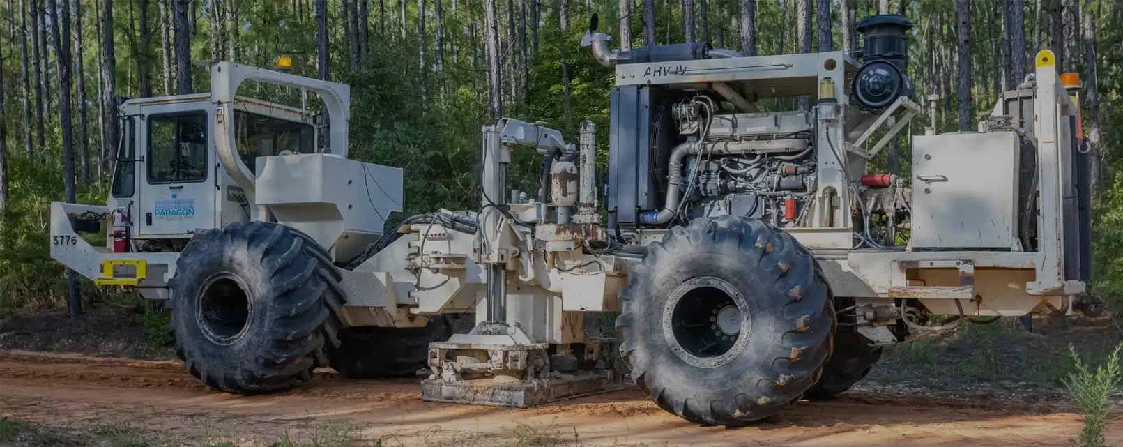
How is this work performed?

A “vibroseis” truck will generate seismic waves, or pulses, underneath the earth’s surface. This truck is equipped with large metal plates, called pads, that send vibrations through the earth. The waves bounce off the multiple layers of rock formations underground and are recorded by geophone sensors to create accurate maps of the complex layers underground.
To collect this information, a crew drills a series of 1.5-inch-diameter holes approximately 3 inches deep and places the geophone sensors into them to detect and record imperceptible ground movement. The geophones are placed every 20 to 40 feet along a bar ditch.
Next, we create waves that travel underground. Once geophones are in place, the vibroseis truck lowers its pads and sends pulses into the ground. (For maximum safety, we also monitor the ground motion near any adjacent structures to ensure that we stay below established thresholds.)
What can residents expect?
When seismic surveys are performed, residents will see a vibroseis truck along select roadways. The truck will generate vibrations that may be felt up to 100 feet. It’s important to note that the vibrations are less than what would be felt from a passing reight train and pose no risk to infrastructure or drain tile. Testing is currently expected to only occur on public right of way and any access to private land will require prior permission and coordination directly with landowners.
Seismic crews will be equipped with high-visibility clothing, lighted vehicles and a flagging/signing crew to ensure other road users are aware of operations over the next few months.
Safety is our top priority. The work will not proceed if there is a risk of damage to roads or private property. Once completed, there should be no sign at the surface that our crew was present.
You can learn more about seismic surveys by viewing this video.